You can get more information on the route from here. There are downloadable pdf files with maps of sections of the route, but the leaflet which covers the full route does not seem to have a pdf version so I have scanned its map.
Two train services serve the route. There is a local service which stops at stations from Edinburgh and North Berwick. In addition to the train service there is a bus [124/X5] which goes from Edinburgh to North Berwick and passes though Musselburgh, Longniddry, Aberlady, Gullane and Dirleton.
Public transport for the eastern part of the path are more of a problem. There is a mainline service from Edinburgh which stops at Dunbar. I have still to investigate bus services.
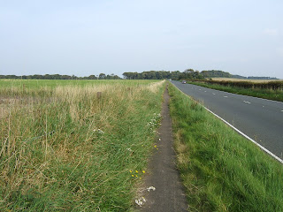
Longniddry to North Berwick - I parked at Longniddry station and walked about one kilometre north to join the coastal path. The 17km [10.5 mile] path to North Berwick is well signposted and almost entirely flat. About three or four miles of the path is next to fairly busy roads. The rest is through woods, alongside beaches and by golf courses. It is easy walking. The path is suitable for bikes and there are no awkward gates or stiles.
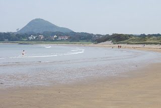
I stayed on the path for most of the way but when I got sight of North Berwick Law [an extinct volcano close to North Berwick] I deviated north and walked along some fine sandy beaches. When I got to North Berwick I caught the train back to Longniddry.
Verdict - an easy walk in pleasant surroundings with good public transport links.
Longniddry to Fisherrow - I parked at Longniddry station and walked about one kilometre north to join the coastal path. The 9.5 mile [approx] path to Fisherrow is well signposted and entirely flat. It can be walked or cycled. It took me about 3.5 hours to walk to Fisherrow.
There is a path through the dunes between the B1348 road and the beach on the section to Seton Sands but it is partly overgrown and poor walking. There are also some streams which are difficult to cross.
I preferred to walk on the road.
The rest of the route is mainly off road. It passes through Cockenzie Harbour and Prestonpans. There is an industrial museum at Prestonpans, though it only appears to be open during the summer months. The route passes between the ugly Cockenzie power station and the sea.
Further to the west there is a large lagoon created by ash dumped from the power station. The lagoons are now an important roosting site for wading birds [you pass bird watchers all along the route]. A path is being created between the lagoons and the sea.
The path ends at Fisherrow Harbour, which is the western end of the John Muir way.
If you walk a little way inland from Fisherrow to the A199 [Edinburgh Road,North High Street]
and then a few hundred yards east there is a bus stop where you can catch the 124 bus back to Longniddry Station. There is a bus at seventeen minutes past every hour. Musselburgh also has a railway station but it is on the outskirts of the town, some distance from Fisherrow.


2 comments:
Its Longniddry not Longniddery btw
The link for the John Muir Way is broken; best one now is probably:
http://www.visiteastlothian.org/walking.asp
Post a Comment